Description
DJI MATRICE 5T
Always in Its Element
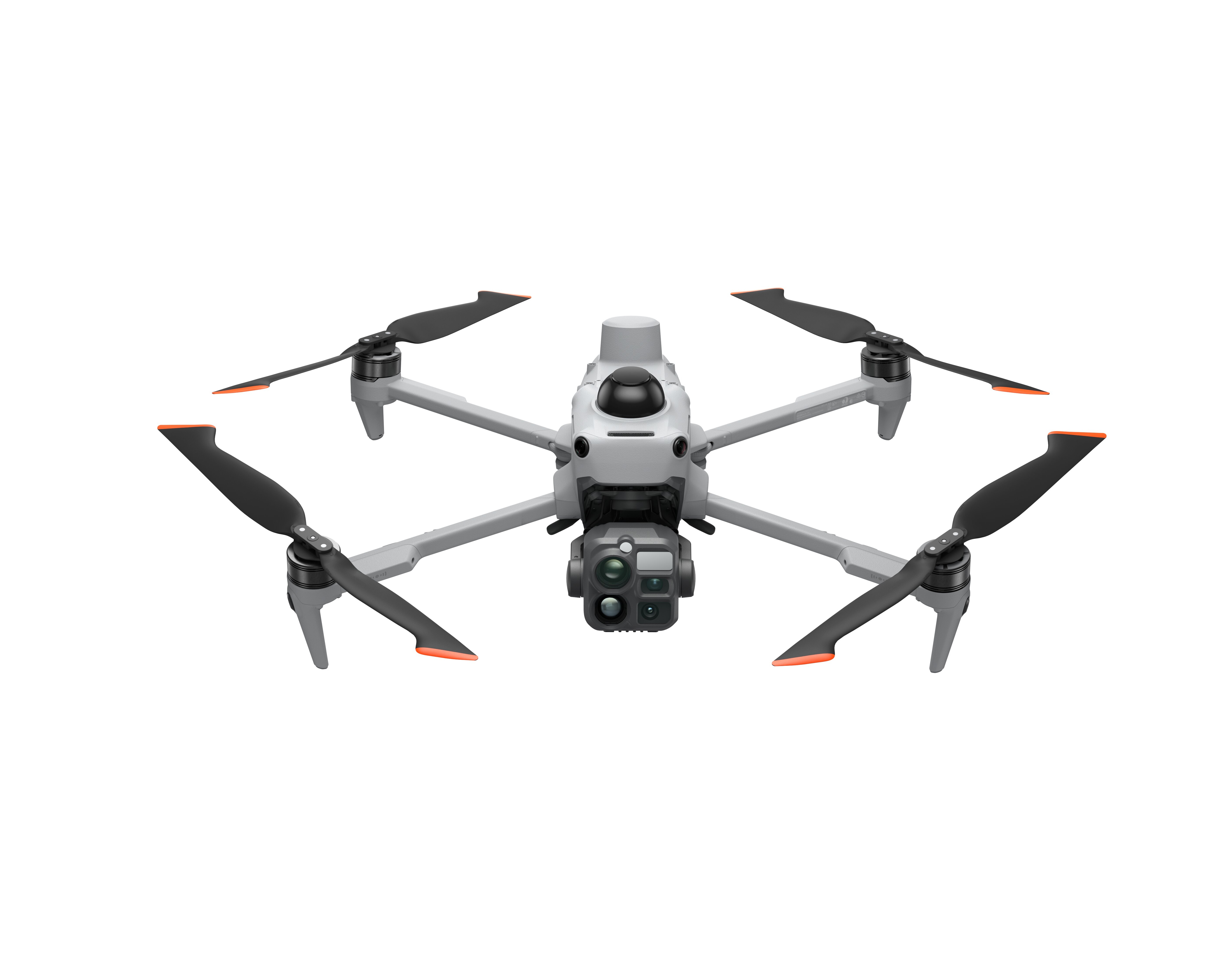
DJI Matrice 5T integrates LiDAR, mmWave radar, and vision sensing with IP55 rating, excelling in emergency response, inspection, and surveying even in harsh environments. 1K thermal and enhanced night vision reveal detail day and night. Up to 59-min flight time and relay modes extend reach, while open onboard AI and Pilot 2 plugin support power smart on-site workflows.
Infrared Thermal Camera, Native 1K Resolution
Featuring a native 1280×1024 resolution, the thermal camera quadruples the pixel count of standard 640×512 sensors. Enable UHR Infrared Image for real-time 2560×2048 footage at 30 fps. Even against complex backgrounds, heat anomalies remain clearly defined.
Wide-Angle Camera, Full-
Color Night Vision
A large 1/0.98-inch sensor and fast f/1.8 aperture capture more light. Backed by AI low-light enhancement, ISO sensitivity reaches 1,600,000, delivering vivid full-color imagery in conditions as dark as 0.01 lux.
Medium Telephoto, Mid-
Range Precision
Equipped with a 50 MP sensor and 3× optical zoom, the camera resolves sharp details at medium range. During power line or bridge inspections, it can detect pins and cracks from 10 meters away and clearly read instrument data at substations.
Telephoto Camera, Monochrome Night Vision
With an 11× optical and 176× hybrid zoom, the 50 MP sensor reads license plates from up to 400 m away. An RYYB array offers greater light sensitivity per unit area than a standard RGGB array, for better low-light performance. Adjusting the IR cut filter further lowers the operational lux threshold.
Ranging and View Assist
Laser Range Finder
With a maximum measurement range of 3 km, the system supports pinpointing, line drawing, and area calculation to quickly mark assets or measure wildfire perimeters.
NIR Auxiliary Light
An NIR illuminator provides up to 100 m of effective illumination, complementing the telephoto camera’s monochrome night vision for clearer close-up detail.
Dual-Light Fusion
Thermal and visible feeds fuse on the remote, enabling temperature checks and alerts directly on the visible view. A dial quickly adjusts the fusion ratio. Split screens display up to 3 simultaneous feeds from wide, tele, thermal, map, and Vision Assist.
Omnidirectional Sensing, IP55 Rating
Built for Challenging
Conditions
As a compact enterprise flagship, Matrice 5T features an IP55 rating, allowing it to operate in challenging conditions including dust and rain. It also performs reliably across a broad temperature range of -20° to 50° C (-4° to 122° F).
Wire-Level Obstacle
Sensing
For the first time in a DJI compact enterprise drone, DJI integrates LiDAR, mmWave radar, and an omnidirectional vision system. LiDAR identifies thin obstacles at night, detecting power lines up to 32 m away. In fog, rain, or dust, mmWave radar cuts through interference to sense its surroundings.
Low-Light Flight Safety
The omnidirectional low-light sensing system uses full-color fisheye sensors to maintain visual positioning in conditions as dark as 0.5 lux, while Vision Assist now provides full-color imagery for enhanced situational awareness. In dim urban areas, vision and LiDAR work together for reliable sensing; in pitch-black wilderness, LiDAR takes over to detect obstacles ahead.
Weak-GNSS Positioning
and Operation
In weak-GNSS environments such as under bridges, in deep canyons, or between urban high-rises, Matrice 5T fuses visual and radar data to map surroundings in real time. This delivers reliable positioning for smooth flight operations.
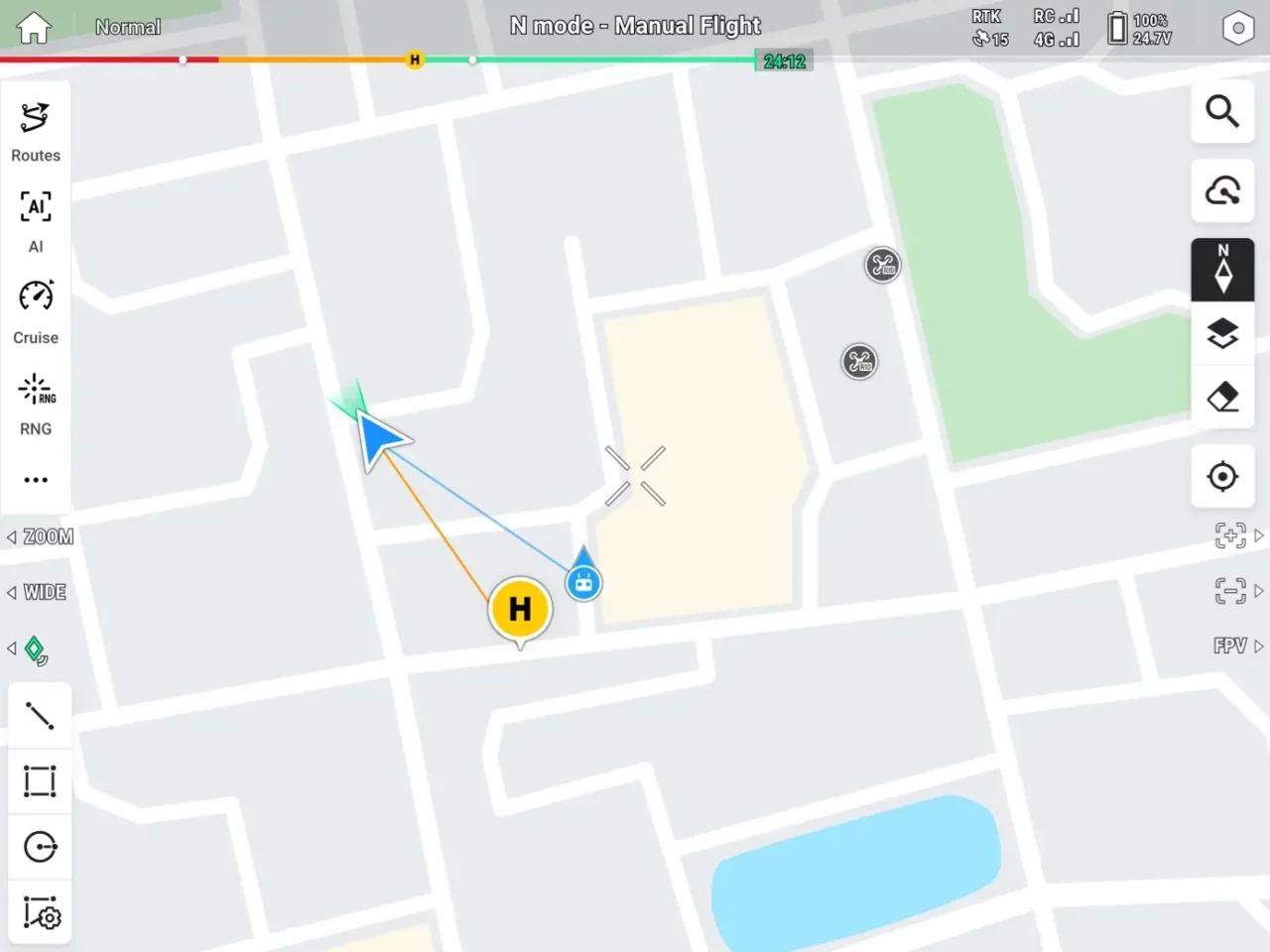
Airspace Awareness
Built-in ADS-B and RID receivers enable Matrice 5T to detect nearby manned and unmanned aircraft in real time, issuing timely alerts. In congested airspace or multi-drone environments, this provides operators with comprehensive situational awareness, helping prevent collisions and maintain safe separation.
Open Edge AI, On-Site Intelligence
Over 20 Target Detection
Types
Built-in AI models detect over 20 target types for broad scenario adaptability. By analyzing thermal and visible feeds in parallel on a split screen, the system swiftly locks onto vehicles, vessels, fires, and other target types. Open onboard computing supports third-party models, allowing flexible deployment of custom algorithms.
FlightHub 2 Multimodal
Cloud Detection
When DJI Pilot 2 is connected to DJI FlightHub 2, cloud computing enables target searches using text or image prompts. The multimodal LLM accurately interprets prompts, detects objects, and triggers alerts, providing comprehensive situational awareness across all scenarios.
AI Patrol Routes
Simply outline an area on the map, and the system automatically generates an efficient patrol route. It detects targets in real time and executes custom actions like hovering, capturing photos, recording video, or broadcasting audio. Post-flight, it compiles results into detailed reports, greatly automating routine inspections.
O4 Enterprise Transmission, Multiple Relay Modes
O4 Enterprise Enhanced Video Transmission System
Leveraging the sub2G frequency band and a high-gain smart antenna array on the remote, O4 Enterprise Enhanced transmits up to 40 km. Adaptive multi-band switching resists urban interference. Dual built-in DJI Cellular Dongle 2 modules enable automatic switching to the optimal network link, maintaining signal stability despite physical obstructions.
Multiple Relay Modes
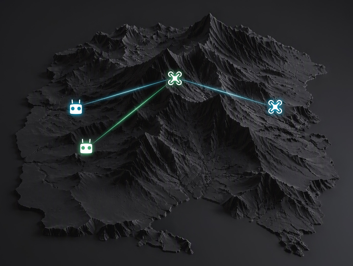
Single-Relay, Dual-Controller
A single relay drone provides signal extension for one operational aircraft, expanding the overall operational range.
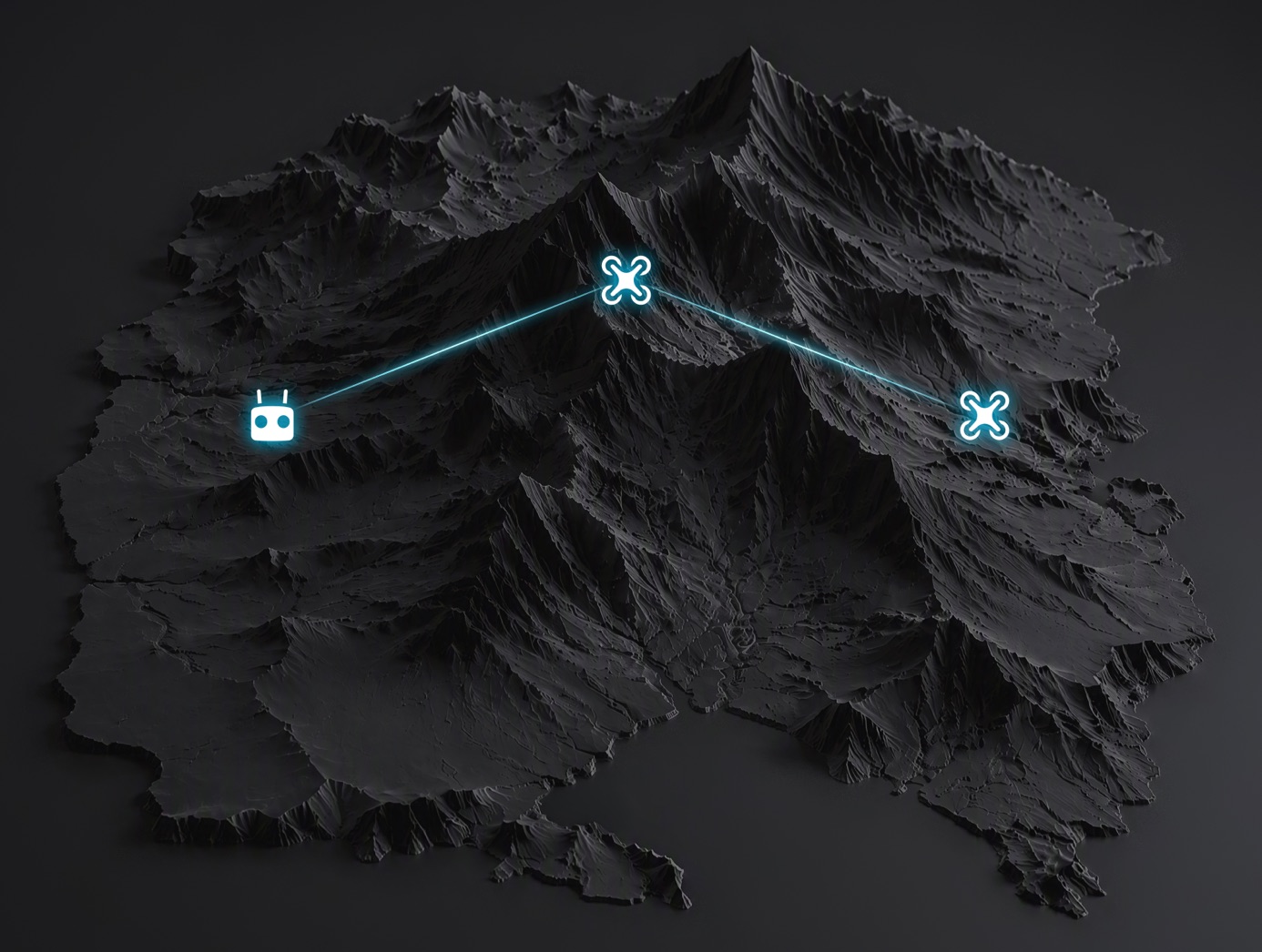
Single-Relay, Single-Controller
One remote controls both the relay and operational aircraft. The relay intelligently adjusts its attitude and hover position to maintain an optimal link.
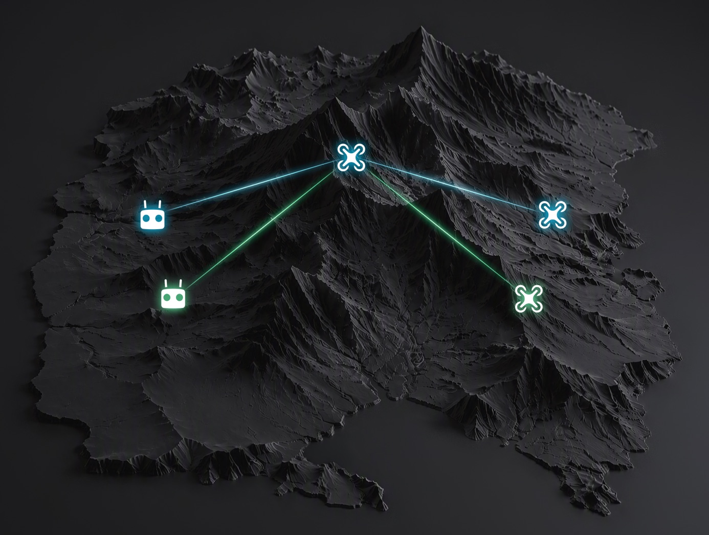
1 Relay, 2 Controller, 3 Aircraft
A single relay drone simultaneously relays data for two operational aircraft, making it ideal for large-scale, coordinated multi-drone operations.
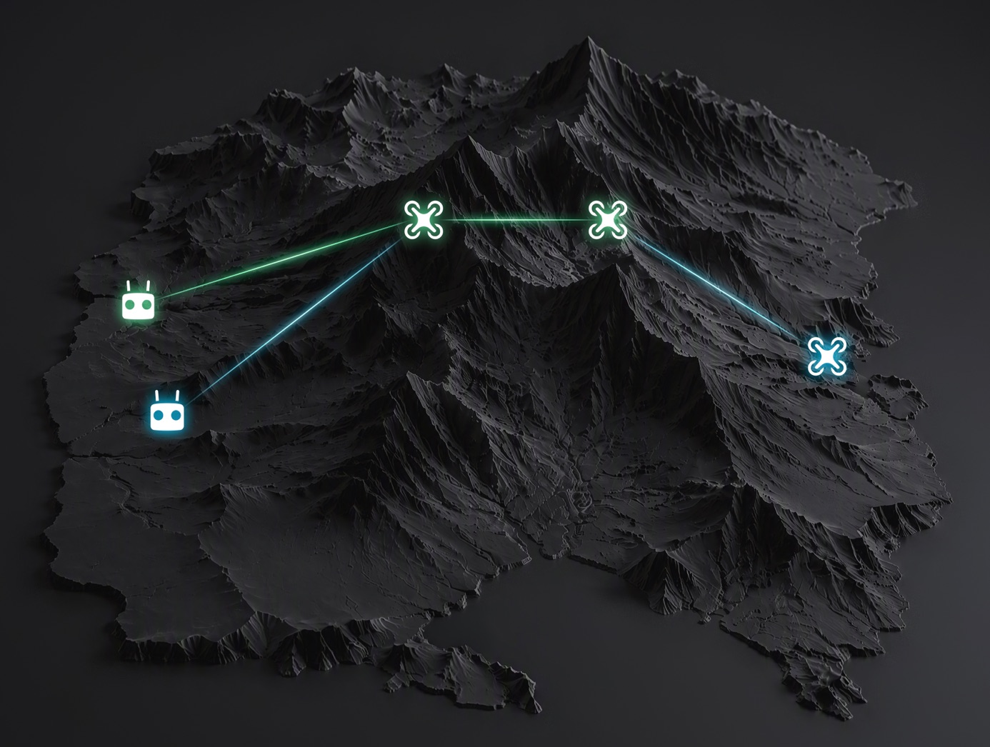
Dual-Relay, Dual-Controller
Two relay drones transmit data sequentially to the operational aircraft, further extending the operational range.
Robust Power, Extended Endurance
59-Min Max Flight Time
Equipped with a 215Wh high-energy-density battery, the aircraft delivers prolonged hover times. A single takeoff covers a broader operational area, reducing battery swaps and site transfers.
Comes With Low-Noise Propellers
The standard propellers feature a bionic “bat-wing” swept tip design to optimize airflow and vortex structures, reducing flight noise to as low as 80 dB(A) while boosting aerodynamic efficiency.
23m/s Max Flight Speed
In emergencies, Matrice 5T powers on and takes off in just 10 seconds. It rapidly reaches the scene to deliver critical live feeds, providing valuable time for subsequent command and dispatch.
Reliable Power Redundancy
Single-axis thrust increases by 98% over Matrice 4T. A phase-loss algorithm detects anomalies in milliseconds. Even with a phase-loss fault, the affected arm still outputs 50% of its max thrust for stable hovering and a safe landing.
High-Accuracy Surveying, Rapid Modeling
High-Accuracy Surveying
Paired with DJI Terra, Matrice 5T delivers centimeter-level surveying accuracy without requiring GCPs. It handles both routine inspections and high-precision aerial mapping.
2D Thermal Mapping
DJI Terra stitches thermal images using visible-light positioning as a reference to create 2D thermal orthomosaics. Read temperatures and mark anomalies directly, improving efficiency for large-scale solar and grid inspections.
Rapid On-Site Modeling
During flight, the remote receives images in real time to rapidly generate local point clouds or 2.5D models. Direct annotation and measurement are supported on 2.5D models. Processing 200 photos takes just 8 minutes.
Smart 3D Capture
Build a rough model on the remote to auto-plan precise routes that closely follow the subject’s surface. Complete detailed modeling in one flight, and view virtual routes and waypoint photos to assess safety and coverage.
Versatile Applications, Custom Pilot Plugins
Foreground Stabilization
A built-in AI foreground segmentation model separates targets from backgrounds during telephoto shooting. This reduces interference, keeping subjects in sharp focus with clear details.
Power Line Inspection
Matrice 5T uses its top-mounted LiDAR to detect and lock onto power and ground wires, automatically flying laterally along the line. This efficiently identifies grid hazards like broken strands or suspended foreign objects.
Pilot 2 Custom Plugins
Developers can integrate custom capabilities into DJI Pilot 2 as floating windows, eliminating the need to build standalone apps. By leveraging existing features, teams can focus on their core business functions.
Boat Launch
For maritime patrols and inspections, Matrice 5T supports taking off from moving vessels. Upon mission completion, it recognizes the landing point pattern on the deck to land.
Software Designed for Industries
DJI Pilot 2
Automate tasks with Cruise, FlyTo, Smart Track, and POI. A split screen displays preset combinations of wide, tele, thermal, map, and Vision Assist feeds, minimizing switching between views. Open plugins integrate third-party capabilities directly.
DJI FlightHub 2
Offers cloud-based aircraft and gimbal control, remote takeoff and landing, FlyTo Task, and Smart 3D Capture, geometric, and slope route planning. A multimodal LLM searches for targets using text or images. Simultaneous live feeds keep air and ground teams synchronized in multi-drone cooperation.
DJI Terra
Outputs 2D, 3D, and point cloud models for GIS, emergency response, and construction. Offline visible light PPK and D-RTK 3 imports improve reconstruction accuracy for GCP-free operations. It also enables 2D thermal mapping, rolling-shutter reconstruction, and video frame reconstruction for advanced surveying tasks.
DTAT 3.0
After completing thermal imaging operations with Matrice 5T, you can use the DTAT 3.0 thermal analysis tool to mark, analyze, and process images, detecting abnormal temperature points.